lundi 4 septembre 2017

Torino Nice Rally 2017

For the second time, in the beginning of September, I went to Torino for the Torino-Nice rally. This rally, launched last year, mixes roads and non-asphalted tracks, in a very loose way as opportunities are left to choose between hard or easy options in many points of the route.Living in Nice I’m familiar with most of these roads, even more since I had ridden the rally in 2016, so while keeping the general direction, I changed a lot of the original route.

The first notable climb of the Rally was like last year Colle del Colombardo, a big and steep pass unasphalted in its higher part. This year I chose instead the parallel and lower Colle Del Lys, that I never rode before, which also links Val di Viu in the north to Val di Susa in the south. I crossed Val di Susa towards Colle Braida, passing along the Avigliano lakes, then below the monumental Sacra di San Michele during the climb. From ColleBraida, a small forest track heads to the north before going down to Val di Susa. In Bussoleno I took the train for a few kilometers, as a ride on the highways of Val di Susa didn’t attract me too much.

I renounced to Colle delle Finestre as I already climbed it twice, so I left the train in Oulx and headed towards Col de Montgenevre on the highway. Afterwards, I regretted not to have climbed to Colle Basset through Sauze d’Oulx, then gone down to Sestriere and Cesena, as it would have been a nicer alternative, although quite harder and longer. In Cesena also, I could have saved me a stretch of highway going through the town center, but anyway, after a few bends, the old Montgenevreroad, very well surfaced and without cars, allows to reach the pass in a very pleasant way.

In Montgenevre, I added an extra of my own, by climbing the col des Gondrans. The climb on the Montgenevre side is on a dirt track mainly used to reach the skiing installations of the ski resort, while the descent is on a tiny, once asphalted but now much degraded, road of military origin. In fact, there are a lot of military remnants at the top and the pass itself is between two mountains, Mont Janus and Sommet des Anges, both topped by ancient forts. They can be both reached by bike, but the beginning of the track to Mont Janus, the highest and most interesting one, looked quite difficult, as for the steepness and the surface. It was the end of the afternoon, I felt too tired to appreciate a hard climb now, so I left the visit to another time.

Instead, I went down on the other side,which reaches the Izoard road a little below Cervières. As I said, it was about 8 pm, I had left Torino at 4 am, so I felt a little bit tired, and I stopped at the first guest house I found, Gîte de Terre Rouge. There I had a nice discussion with the tenant. He showed me a picture of him on a bike, with a pair of shorts he
told me was given by Jacques Anquetil himself! We talked also about my ride, and he showed me two alternate ways to go down from Izoard: one by col des Tronchets that is reached with a track that leaves Izoard road just after Casse Déserte, and another one that starts in La Chalp, going by lac de Roue and the village of Souliers. According to him, the col des Tronchets option presented some parts harder to cycle, so I chose the second one, and I didn’t regret it. It broke nicely the cold descent from the Izoard, and it made me discover the very steep and narrow road down from Souliers to Château-Queyras, that deserves well to be done uphill one day.

After that came classic climbs of the Agnel and Sampeyre passes. Just a few days before, the climb from the village of Sampeyre to the pass had been forbidden by Sampeyre mayor to all bikes and motorcycles, and signs had been put across the way. Well, like in col de Larche, it was some kind of virtual interdiction, I came across the barriers and reached the pass without any problem.


The asphalted road that links Val Varaita and Val Maira crosses at Sampeyre pass an old military track. I had ridden the eastern part last year, so I went westwards this time. The track follows the ridge for a few kilometers, always on the Val Maira side, and terminates in Colle della Bicocca. From the pass, you have nice views to Agnel Pass and Pontechianale below, and also to the valley of Bellino, another branch of Val Varaita that leaves Agnel road a little below Pontechianale.

After colle della Bicocca one has to turn back as only foot paths continue after the pass. A very rough track, halfway from Sampeyre pass,goes down to the village of Elva. Then came one of the highlights of the trip. Although the pictures I could have seen from Elva road looked spectacular, I never had the opportunity to ride it
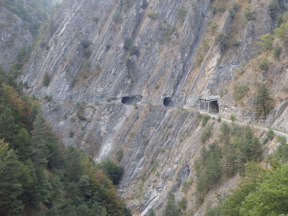
before. The door to the so nicknamed Strada dell’Orrido (road of the horror) is a little tunnel, and a Madonna statue with a marble plate aside bearing the names of the people that found death on the road. Then during 4 km the road goes down, hanging on the cliff, halfway between the bottom of the valley and the mountains above. All along the way the road crosses protections from avalanches, tunnels directly dug into the rock, with a rusty railing on the valley side, all of this giving the impression of having been built in a very artisanal way. Needless to say that despite what I have seen of this road before on the web, I was totally stunned from what came in front of my own eyes!

After a cold night in the Marmora camping (I wouldn’t recommend it unless maybe in full summer, as being close to the river, it was very cold and humid in the beginning of September) I started the climb to Esischie pass. Like for other places crossed by the official route of the rally, I didn’t go to Altopiano della Gardetta having been there last year. But I highly recommend visiting this place, which is certainly one of the most beautiful in the Alps. You need a MTB to go through the entire track, but you can have a nice preview by taking the 100 m diversion to colle Valcavera, 2 km below Fauneria pass, on the Demonte side.

All along the climb, I saw a lot of marmots that kept me company with their whistles. After
Esischie pass, a small climb leads to colle dei Morti (Fauniera) that is followed by a long descent to Demonte. In Demonte the route continues to the steep but short climb to Madonna del Coletto. Down in Valdieri and Val Gesso, the route proposed between Roaschia, in a lateral valley of Val Gesso, and Vernante a non-asphalted pass called Colle delle Goderie. I already climbed it last year, and I remembered having much difficulty. As I had started it in the beginning of the night, I wanted to see if it would appear easier in a normal part of the day. Well, in fact it is really difficult, and much higher than the 1230 m announced at the summit.

When I reached Vernante the rain began to fall heavily while I was climbing towards Limone. The rain was so strong in Limone that I stopped for a while, but the thunderstorm decided to stay over Limone, so after having stayed one hour under a shelter, I decided to stop for the night.


The morning after, sun was back and I started my ride with a climb to col de Tende. With my early stop the day before, I was too short in time to cycle the very hard tracks that go east after the pass. Instead I went towards baisse de Peyrefique. I already rode this track and knew it was much easier, and still in very mountainous and beautiful landscape. After baisse de Peyrefique, an intersection allows to go down to Casterino or to Baisse d’Ourne then Tende. I went to baisse d’Ourne that I reached after a short and gentle climb. 

After the pass the track is very rough, and I think hardly rideable uphill but I was going down. After a long, shaky and cautious descent, the track turned into a very narrow, roughly asphalted road down to Tende. When I reached the bottom of the valley, I continued on a small road that led me to the Roya main road at the pont des 14 Arches, and then down to Breil-sur-Roya station.

Like last year, I finished my trip with the train. After four days on the road I was happy to come back home quickly, although I think the roads and tracks around Nice are among the best parts in the world to ride a bike.
vendredi 28 juillet 2017

Trans Continental Race 2017

The Transcontinental Race, or TCR, is (or is supposed to be) a race across Europe, where cyclists must go through three to four control points along the way, but are left free of their route between the check points. The first two editions started from London and finished in Istanbul, then the start was moved to Grammont (Geraardsbergen) in Belgium, and this year, for the first time, the arrival was not in Turkey, but at the Meteora monasteries, in Greece. The check points included Lichtenstein Castle in Germany, Monte Grappa in Italy, Hotel Sliezky Dom in Slovakia and Pasul Balea in Romania. So with the start and arrival, there were 5 BIG out of 6 control points!

When this race appeared some years ago, my first feeling was that it was completely stupid, to cross Europe on highways as fast as possible, instead of visiting beautiful places on the quietest possible roads. Well, as years passed by, this race grew in importance and renown, at least in the little world of long-distance cyclists, and finally, having a bit forgotten my first opinion and letting me influenced by all the hype about this race, I registered for the 2017 edition.

The most difficult part of the race, once the check points are known, is to build a route, trying to find a compromise between a fast and a secure itinerary. I started this job seriously, building a first stage that turned out quite satisfactory on the ground, but after a while my natural laziness made me postpone a little the rest of the work. Suddenly, in the last day of March, came the brutal news that Mike Hall, the emblematic organizer of this race, had been killed in Australia, while riding a race similar to TCR. This terrible event appeared immediately as to provoke a cancelling of the TCR, and in fact we were left for months without notice. As I said, my feelings about the race were mitigated, I wasn’t not sure anymore, after my application had been selected, to still want to be on the start line, so I left things go, taking the assumption that the race would finally not take place.

So when the race was confirmed, less than a month before the start, I had to quickly finish my route, and building a route on the scale of a continent is a big task, as one can imagine. As a result many parts of my itinerary were made in a hurry, especially in the easternmost countries, and that worried me more and more, as the departure date approached.

Anyway I was in Grammont the day of the start. I went through registration procedures, bike check, riders briefing and so on. After the briefing, I had a nice meal in a Grammont restaurant with Maxime that I knew from the tour de l’Aude the year before, and Erwann, another rider. I spent the time remaining unpacking, re-packing and re-re-packing all my stuff, before we were finally sent away at 10 pm. We started by a little loop in the streets of Grammont, finishing by the famous Muur. At the top of the Muur was the real start of the race, where we were left on our own, free of our itinerary, night and day stops, etc.

The first night in Belgium was nice and quiet, a bit hillier in the end than I had expected. I went briefly through France in Givet then reentered Belgium. In the very morning I broke a spoke and had to ride 80 km before I could have it fixed in Luxembourg. Leaving Luxembourg for Germany, I rode along the Sarre, on a very nice cycle lane. I entered France again in Sarreguemines and went through very nice landscapes between this town and Haguenau. I crossed the Rhine and the French-German border in the beginning of the night and had just after my first night stop.

For my night stops, I had what is called a bivy bag, which is something like a big sleeping bag, but made with tent material. Therefore it is proof to rain, but very light and can be easily carried on a bike as there are no mats and pegs. I’ve never used much this gear since I bought it, but during TCR I found out it was really convenient: whenever I felt sleepy, I just had to find some place a bit hidden from the road and take out my bag to be at home.

The Sunday morning I began my first long climb, as I had to cross Black Forest. I arrived by noon at the first control point, Lichtenstein Castle, a nice little castle which overlooks the valley below. After the check point, I continued my way, which was to go through Germany, Austria and Italy, to the second control in Monte Grappa. I then experienced for the first time the riding along highways, as I rode towards Ravensburg and Bodensee. It was a very uncomfortable moment, but more were to come. I reached Bodensee and Austria by night and stopped for sleeping just before a storm, below a footbridge by the railway.

I spent very little time on the Austrian part of my route as it appeared obvious to me on the map. It seemed to go directly from Bregenz to Landeck where I had to turn south towards Italy. I just didn’t realize that there was a mountain range in the middle and that I had to pass over the Arlberg pass! So the climb after Bludenz appeared to me quite hard for what I had expected to be a gentle valley climb up to Landeck. And worst of all, I found out in Klosterle that due to works in the road tunnel, all the traffic was diverted to the road that I was supposed to take, and therefore it had been forbidden to bikes. It was an uninterrupted passing of cars and lorries, so it appeared impossible to me to continue on that road.

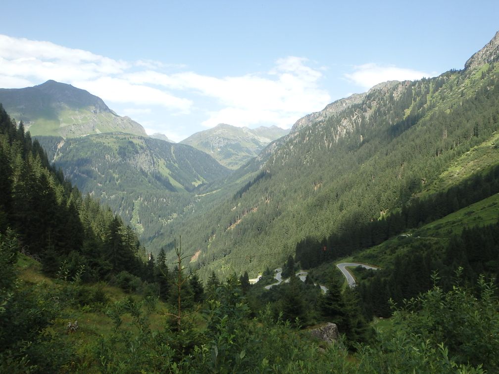
At first no alternate other than a detour of hundreds of kilometers appeared to me, then I saw that a nearly parallel pass existed a little south of where I was, and what’s more it was a BIG, Bielerhöhe! Paradoxically, this detour made me happy. I knew it would allow me to climb a BIG in a new country, Austria, and it delivered me also to the last concerns about the TCR classification I may have had by the time. Furthermore, as I was cycling among the switchbacks of the Silvretta, it reinforced my conviction that the cycling I like is climbing mountain passes in beautiful sceneries.

I was finally in Landeck where I started the climb to Reschen Pass (this one I knew it was there). I was by Reschensee at night, so I saw the famous campanile illuminated above the water. The following day I went down the Adige valley. I felt rather stupid to ride all the way on the monotonous cycle path in an intense heat while beautiful climbs expected me on each side of the valley.

As I was getting closer to Monte Grappa, I felt a bit worried about it, as I knew it was a long and steep climb. I had been riding day and night for four days now, I felt of course tired, and my bike was loaded with all my travel equipment. I felt that my 25-teeth cassette would be hard to carry up to Monte Grappa, so I was considering buying a larger one. I was lucky to find a 30-teeth one in Levico Terme, after having cycled along the nice Lago di Caldonazzo, and I sent the other one back home.

The second control in Semonzo, at the foot of Monte Grappa, was very long to arrive as it was the end of the day. It was located in a camping where I had a good meal, was able to wash my clothes and to sleep a little. The morning after I climbed Monte Grappa under a beautiful sun and was happy with my new cassette. After some severe ups and downs (and a little ride on a wrong road) I was back in the plain at Pederobba.

The following days I crossed the plains, riding along corn fields in Italy, Slovenia and Hungaria under an intense heat wave. The temperatures were around 40° all the time. I drank my two bottles in no time, so stopped very often in bars to fill, drink sparkling water, eat ice creams … After entering Slovenia, I had a long climb where I could have had good views above the valley below but was there at night. Leaving Ljubljana I struggled to find a cycling path to Domzale as my route was directed towards a highway forbidden to bikes. After Slovenska Bistrica I had to divert my route as I found myself again on a road where bikes were banned.

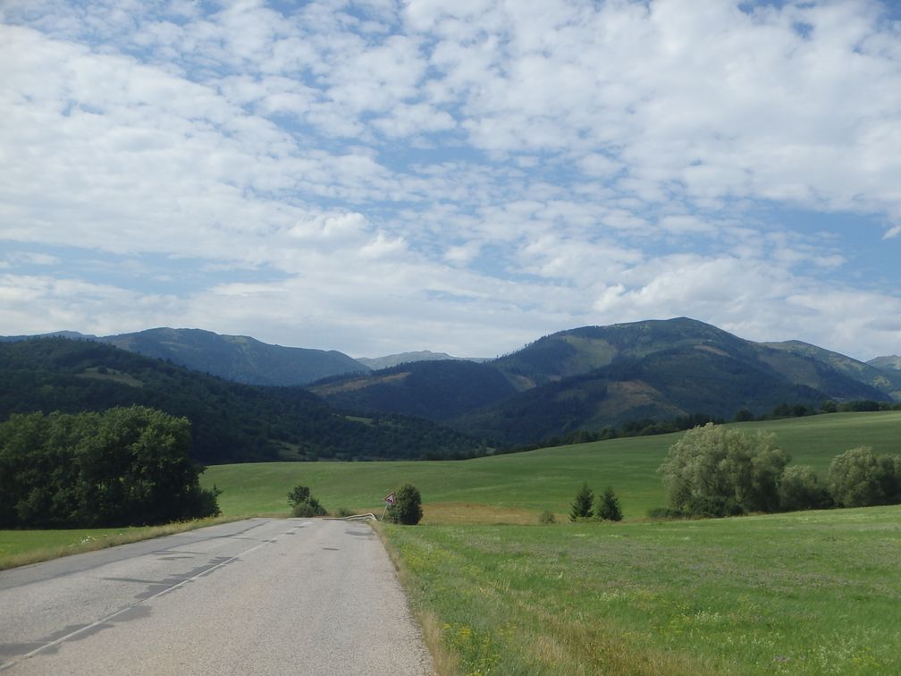
I entered Slovakia in Komarno. I rode on a highway, but with reasonable traffic and a large shoulder. But just after a crossing, traffic increased brutally while the shoulder disappeared. I couldn’t stand the traffic as lorries were passing me by so close, so I tried to find other roads. I took some little roads, which turned out to be very hilly and steep. I came back to my planned route hoping that road 66 would be better, but it was the same, so I diverted again as soon as I could.

I was then on a quiet road, but lightning in the distance began to worry me. It was late night so I started to look around for a shelter. I was then happy to find a 4-star hotel in the changing room of the Senohrad football ground. The day after was nice as I rode on normal roads and climbed my first ever Slovakian BIGs. First I went over non-BIG passes, TistyJavor and Pohansko, then I reached BIG Sedlo Čertovica, in the Lower Tatras, as I had to cross this mountain range to get to the third control point in hotel Slieszky Dom, another BIG.

As I said, I had bad times on Slovakian main roads, praying that it would overtake me far enough each time I heard a lorry coming from behind. At the check point, two things made this unease grow. First I learned that a rider had been killed in Belgium at the beginning of the race, and then we were told that the A1 road in Romania had been judged so insecure by the first racers that it had been banned subsequently by the organizers, and I had to build a new route on the fly from a map that was there at the control point. So, when I left Slieszky Dom, I felt very uncomfortable about the rest of the trip. I knew that my route included a road forbidden to bikes in Hungaria, as it was the only way to cross a river hundred kilometers around, and the A1 incident made me worry about what I would find later in Romanian roads and further.

During the following hours, my unease didn’t decrease, I couldn’t stand no more highways and began considering quitting the race each time I found myself on a busy stretch of road. I went nevertheless through nice places during this time, like Dedinky Lake in Slovakia, but when I found myself again in the Hungarian plain, I was ready to give up. Furthermore, the mythical dimension of the crossing of a continent of the TCR that had driven me since the start was beginning to fade away. I had already ridden 2500 km, 1500 km were left so less than some of the randonnées I did in the past. Continuing now appeared to me more and more as pedaling stupidly on and on along highways during a few days more.

So when my route went near a train station, Sajószentpéter-Piactér, I decided on a sudden impulse to stop my ride and turn back home with the train. It was a very little halt with no more than a platform along the rails. As I was getting to the station, a train arrived, but it was gone before I could get to it. Before I could decide what to think about that, another train arrived in the opposite direction and I jumped in it not knowing at all where it would take me. It happened that this train was going to Miskolc (the first one would have taken me back to Slovakia) where I was able to take a train to Budapest.

In Budapest my troubles were not over. The trains that would take me back home were all full for bike transportation and I didn’t know at all which alternate solution I could take. At the same time, for the first time of my trip, the weather was awful with a continual rain that I really didn’t have the courage to face on my bike, now that I had taken my decision to stop. As it was getting late, I decided to go to sleep and see the day after. But all the hotels around the station were completely full. Finally the 6th or 7th I tried had a room for me, phew!

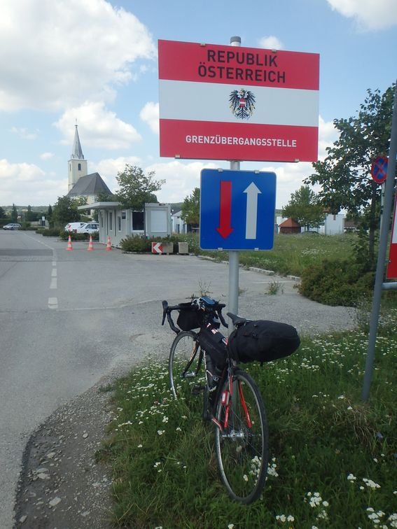
After a good shower, I looked at my situation and decided that a solution would be to go by train to Sopron, close to the Austrian border and ride to Wiener-Neustadt to reach the Austrian rail network. So in the morning I went, still under the rain, to Budapest-Déli station. In Sopron I had a little ride under a sun happily returned, and in Wiener-Neustadt I could take a ticket to Milano, changing in Venezia and Verona. After Milano I couldn’t go further than Albenga that I reached by midnight. I had plenty of sleep in the trains all day long so I was able to continue to Nice by bike during the night, where I arrived at 5 am.

Despite the fact I decided not to continue to the end, I keep good memories of my TCR. I enjoyed being on my bike all the time, travelling on permanently changing countries and landscapes. When I try to think rationally, I come back to my initial opinion that riding like that along highways, with no other motivation than arriving, is no fun, but at the back of my head I still know that the initial goal has not been fulfilled, so I can’t help but thinking “But what if I prepare my route in a better way?”.

dimanche 25 juin 2017

999 Miglia

This randonnée is the equivalent for southern Italy of the 1001 Miglia, that exists for several years, and that I rode in 2016, 1001 Miglia being located in northern and central Italy. Like 1001 Miglia, it is approximately 1600 km long, and both are now part of a new four-year challenge, called Grand Tour d’Italia, that will include also a randonnée around the Alps in 2018, and a two-part randonnée in the islands, 600 km in Sicilia, 600 km in Sardinia, in 2019. The organizers kindly put three BIG on their route, which was a good bonus for me.

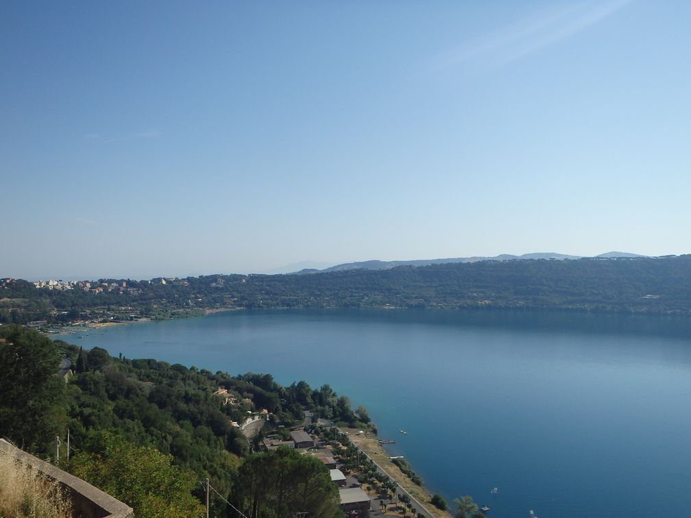
The randonnée started in Roma the last Sunday of June. It was a very nice trip as it was designed to take us around some of the most beautiful sites of the country. The start was for instance in the Circus Maximus in Roma. The first notable site was Castel Gandolfo, where the popes have their summer residence. This place overlooks a very nice lake, with strangely steep banks.

We followed our way down to the sea at Sperlonga, with wonderful views to the coast and the Ischia Island, then we got back into the lands to visit Reggia di Caserta, a very impressive building, and Pompei, where I arrived at night, so saw nothing of the roman town, but had a look at the very nice cathedral. By the morning, I reached the sea again in Sorrento, where I had a little sleep before climbing the first BIG of the trip.

Picco Sant-Angelo is not the hardest BIG on earth, but it opens the road to the very scenic Amalfi Coast. The road follows the coast, half-way between the sea and the cliffs above, with wonderful views to the sea below and the villages with their houses built above each other on the steep slopes of the coast. After Salerno, we headed to Paestum, where we cycled across the archaeological site and its impressive Greek temples.

From Paestum the route went eastwards. I was happy to find a group of riders for the stretch up to my second night stop in Tricarico. The day after we passed by Matera and its famous Sassi, a borough where houses are dug into the rock. After Matera came my toughest moment of the trip. It was mid-day, end of June and the temperature was about 40° C. We were riding on a rather unpopulated area, with no villages (and no fountains) along the way. With the heat, I drank a lot and I saw the moment I had to stop in one of the scarce farms to ask for water. So I was much happy to arrive at the town of Mottola, where I was able to drink liters, eat an ice-cream and cool down a little for the rest of the trip.

After visiting the nice town center of Martina Franca, I arrived in the country of the trulli. I had already heard of this typical form of building, but I hadn’t realized it was so extended. Trulli can be seen all around and inside Alberobello, the capital of the region, and are very numerous. One out of two or three houses in the area is in fact a trulli. After Alberobello, we followed our way to the Adriatic Sea and Polignano a Mare ,then began our westwards return to Roma. I had another night stop in Castel Del Monte, that we saw all illuminated on the top of its hill long before we arrived.

The next day was frustrating for a BIGger as we passed along Monte Vulture without climbing it. But after the last night stop in Morcone, came a more rewarding day in Matese and Abruzzo. We started with the climb to Bocca della Selva from which Sella di Perrone is reached going downhill (I know, I know, this is not an official BIG side, but I’ll come back). Then we passed along lago del Matese, lago di Gallo and lago di Barrea before starting the climb to Passo del Diavolo, third and last BIG of the randonnée.

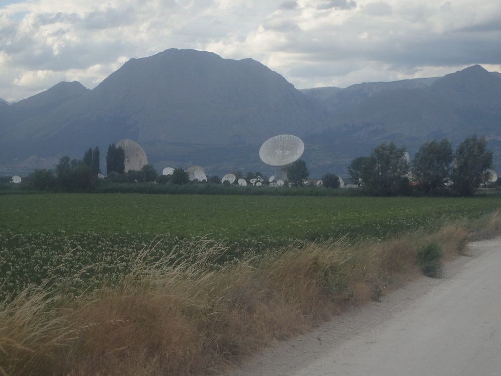
After the descent of Passo del Diavolo, we came across Fucino, a very large and totally flat dried lake with a spatial center full of antennas in the middle of the fields. The town of Avezzano was at the end of this part and after began a gentle climb to Colle Civitella. I arrived at about 1 am at the last control in Castel di Tora. There, I was wondering if I was going to sleep or tried to reach Roma the same night, as we were only 80 km away, with more downs than ups, so it looked like the arrival was now very close. At this moment, I was asked by another rider what I wanted to do, as he told me he was leaving now. This decided me, so we were three, an Italian, a French and a Swedish to go into the night for the last stage.

Well, I regretted it a bit, because, soon after we left, I began to feel very sleepy. I told my fellow riders that I would stop for a rest, what I did. But despite having slept a little, I felt still very asleep while riding. The coffees I drank along the way in the bars I was lucky to find open at such an hour didn’t make much and I had to stop again, taking some minutes of rest leaning against a tree in the outskirts of Roma. Finally, the arrival of daylight woke me a little and I was able to ride the last kilometers to the finish line, where I was rewarded with a beautiful certificate.

I then went to the central station to get a train back home. Many trains were full so I had a few hours before being able to take one. I knew I was in Roma, I had made at home an itinerary to visit all the famous sites of this capital, but all I was able to do at this moment was to seat on a bank in a nearby square and sleep until it was time for the train. But I’ll be sure back in Roma, as lot of BIG still await me in southern Italy.

vendredi 7 avril 2017

Paris-Roubaix (and the BIG around)

At the end of year 2016, three of my friends, Pascal, Marc and Patrick, decided to register for the Paris-Roubaix race, which was to be held Saturday 8th of April, the day before the famous pro event. I was very attracted by this mythical race, but, in a general manner, I have difficulties to make plans like that months ahead. Furthermore the distance to the start line appeared to me quite important for a one-day event, so I didn’t follow them, but with some regrets.

Months went by, and a few days before the date, I suddenly realized that the Lille-Nice football match was scheduled the same week-end. I wouldn’t have crossed the whole France for just Paris–Roubaix, or for just the football match, but a combination of the two was sure not to miss. What’s more, it was the beginning of school holidays, so I was freer at home, and another colleague, Fabrice,who was going to Paris on the Thursday proposed to take me in his car. So all the stars were aligned and I couldn’t do anything else than go.

The journey started with an early ride, as my driver lived 30 km away from my home and gave me a meeting hour of 6am for the start. After that, I had time to relax in the car, and we arrived in Paris in the afternoon. I then went by bike to the Gare du Nord and took a TGV (high speed train) that had a space for bikes (with a 10 € extra fee). So the Thursday night I joined the three others in the flat they had hired in Roubaix.

had of course targeted the surrounding BIG, in Hainaut and Flanders. The day after my arrival, I then went for a ride, alone because the others had already climbed all these BIG, having raced De Ronde van Vlaanderenthe year before. I started with Mont Saint-Aubert, then Mont de l’Enclus that I climbed down on a forest track, and the famous “berg” of the Ronde: Vieux Quaremont, Paterberg, Koppenberg and some other ones I had added when designing my route at home. At
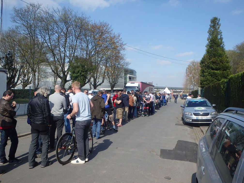
first I had excluded the Mur de Grammont, as it was a bit away from the others and I knew I would be back in Grammont in July for the Transcontinental Race. But the brutal death of Mike Hall, organizer of the TCR, just a week before had made the holding of the event much questionable (in fact it took place, but it was all but certain at the time). So I finished my BIG collection with Mur de Grammont, then turned back to Roubaix, with Kruisberg on the way, to get my package for the race (queue on the picture aside).

In the evening, as promised, I went to the Stadium, where I was happy to see my favorite team win with two goals of the famous Italian player Mario Balotelli. The match finished at 23 pm, and I had to be at 5am in the morning at the meeting point for the coaches that would take us to the start line in Busigny, 100 km from Roubaix. As I didn’t want to disturb my friends with such a late come back and early leave, I went into a hotel in Roubaix, where I was not the only cyclist of course.

The departure of the coaches was very delayed, as we were still waiting in the buses at 7am. Finally, we left for Busigny that we reached after more than one hour of driving. So I was at the start line at about 9pm (there was no group start, except at 7 pm for those who were there at this time). This late start didn’t bother me too much as this two hour delay allowed me to benefit from less cold and wet conditions at the beginning of the ride.

I finally discovered the famous cobblestones of Paris-Roubaix, and I have not been disappointed! Compared to the cobbles I had ridden the day before, the contrast was brutal. The cobbled stretches are little paths between the fields, used by tractors, with very big and bad joining pavés. When you discover that, you think that the idea to ride a bike here is weird, so a pro race!

As more as I could, I rode on the tiny dirty part of the road, between the cobbled part and the field aside (sometimes visiting the field aside). At each cobbled stretch’s beginning, there was a sign telling which color it was, from blue the least, to black the most difficult. A special mention to Trouée d’Arenberg, as here the cobbles are bigger and shake more than anywhere else. And all along the 2 km cobbled track, there’s a nice, smooth and very inviting cycle lane, but what would be the use to come here if it was to cycle this lane?

At the end of the first cobbled sector, I wanted to drink and I realized that my bidon was gone away, but it was not a problem as every 10 meters bidons were lying on the ground. So I picked one which luckily stood better on my bike and that I kept to the finish. I was less lucky with my multi-tool, because I realized when I arrived that I’d lost mine, so I had to buy a new one, after having neglected all the ones I saw on the road.

The arrival at the Vélodrome de Roubaix was the last great moment, to ride on this track I have seen so many times when watching race arrival on television. Having never ridden on a track like this, I was surprised by the inclination in the curve. At a momentI rode too slowly and I was too high on the track to feel secure, so I came back soon at the bottom of the track, strange impression.

All in all, Paris-Roubaix appeared to me even harder and more mythical than before I saw it from the inside. As a cyclist races watcher, I have been in awe of what the riders were doing, but now I am even more admiring. And it was a sunny day! I still wonder how it can be ridden under the rain, with all the mud on the tracks.

The day after, the four of us moved to Bailleul by car to ride the Gand-Wevelgem BIG of this area.My friends had hired a small van, with three seats at the front and an empty space at the back. So I travelled to Bailleul in the dark, among the bikes, holding them in the curves. It was not a long way anyway and we were soon on our bikes.

First it was a flat part to Mont Cassel, and then we began the climbs. The ride we had planned was not very long, but the tendency of my friends to climb every side of the BIG lengthened it a little. Furthermore, we added the climb to Mont des Cats before going to the next BIG, Mont-Noir. After Mont-Noir, we wondered with my friend Pascal why we had both a trace that made a detour before going to Rodeberg (I was happy because Noir was black, and Rode was red, and red and black are the colors of the OlympiqueGymnaste Club de Nice that I saw winning in Lille two days before). We then realized that the summits of these two BIG are very close to each other and we wouldn’t have climbed anything if we had gone directly from Mont Noir to Rodeberg. So we went down and climbed Rodeberg from the official BIG NW side.

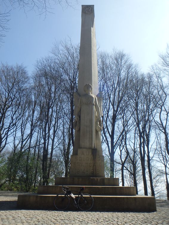
We then just had the Kemmelberg to finish. I was happy to reach the war memorial at the top, as it was the last of this fructuous 10-BIG weekend (even if here again, we climbed it once more from the north-east side). After Kemmelberg, we just had to get back to the car, but as we were some 30 km from the house, I said I’d rather go back by bike than at the back of the van. I was joined by Patrick for this ride back home. At a moment, we were fooled by the GPS that led us to a dead-end, so we asked a local cyclist, whose advices lengthened our route of no more than 10 km, but we were finally back in Tourcoing.

Then, I left my friends, as they had a plane back home later in the evening, and they wanted to go to see the pro race meanwhile. In Lille station, I was told that, due to the beginning of school holidays, I couldn’t expect to take my bike in the TGV. So, I had to take six different trains to get back to Nice, passing by Arras, Paris, with a stop for the night at my sister’s home, Dijon, Lyon and Marseille before finally reaching Nice in the evening of the Monday.

mercredi 26 octobre 2016

Italian lakes

For my usual Toussaint (All Hollows) trip, I chose like last year to go to Italy. This time I targeted the 12 BIG between Chiavenna and Ornavasso (11 in Italy and 1 in Switzerland). I would have added with pleasure Passo San Marco and Val Malenco to my program but as I wanted to be back in Nice for the Nice-Nantes football match, I had no time for them.

As I did several times before, I woke up at 2 am (it’s early) to catch the 5 am train from Ventimiglia to Milano. I chose to start with the Menarola climb so headed to Chiavenna. In fact I wanted to stop at the station before, but as it was quite a long name (Prata Camportaccio) I couldn’t remember it and took instead a ticket to the simpler Chiavenna. From Milano one has to take the train towards Tirano then change in Colico.


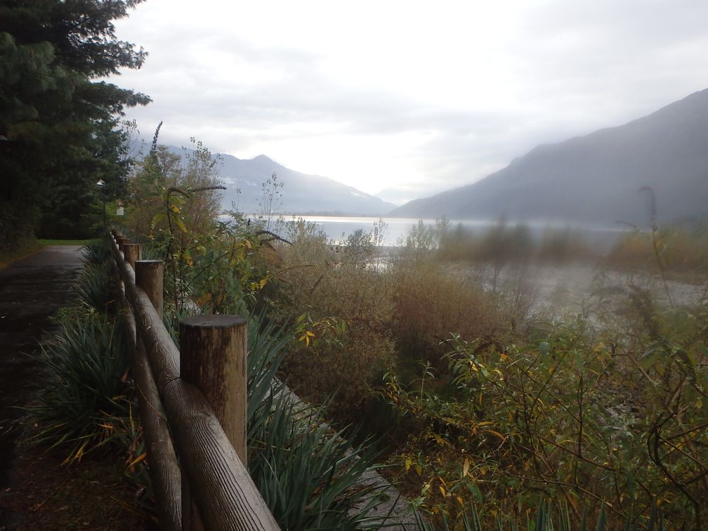
I discovered in Colico that, due to works on the line, the train didn’t go further than Novate-Mezzola. So I began my bike ride a little sooner than expected. After a few kilometres on the busy valley road, I saw on my left a nice cycling path, along the Mera River. In Ponte Nave there was a bridge crossing the river so I quit the cycling path as I knew Menarola was on the right bank. But another bridge 3 kilometres further took me back to the same cycling path. I finally found the good bridge to reach Gordona and the start of Menarola climb.

As I climbed this tiny road in the forest, I was confronted in some parts to carpets of fallen leaves, a feature that would follow me the entire trip. Thanks to my 25 mm Pro3 tires (no advertising, but I found they performed extremely well), I was not too bothered by that (with one exception, we’ll see later).

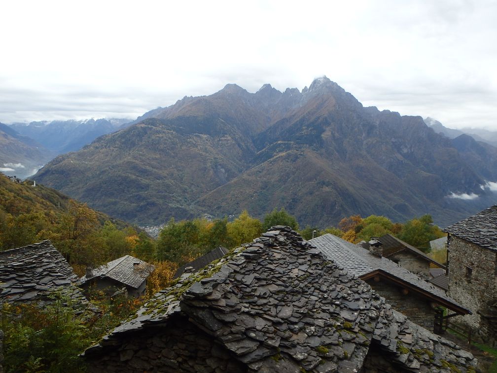
During the climb, I could enjoy some nice views over Valchiavenna, the valley that leads to lago di Como, and Val Bregaglia, the one going east towards Maloja pass and Sankt Moritz. After having passed the houses of Voga, I finally arrived at some lonely houses in a curve, where the asphalt stops. I continued for 400 m and arrived at a pylon where I stopped, as the track in front of me seemed to get “wilder”. Further investigation back at home showed me that I was just 150 m away from the end of the road, so it would have been maybe a better place for a finish.


Down in the valley, I stayed on the bike path all the way this time, down to lago di Mezzola where it finished. In Colico I stopped for a snack. When I got out of the bar, the rain started, and was to continue all the rest of the day. I followed the road along the north-east shore of lago di Como, and turned left in Dervio to climb Monte Legnoncino. In Tremenico, the place where the dead-end road to Monte Legnoncino leaves the Valvarrone road, a hotel was indicated. As it was still raining and night was arriving, I asked for a room but I was told at the bar that the hotel was closed. So I had no choice but to keep on climbing.


It was some kind of horrible climb, in the night, under the rain. The wet pine needles kept on gathering in my brakes, so regularly I had to stop to take them off. I finally arrived at some car park, with big stones on the ground. My GPS showed me the road was continuing, but it turned to be a forest track. Unaware of where the BIG was set, I wanted to follow the track to its end, but renounced quickly. Riding in the dark, under the rain, and on a non-asphalted track was too much for me, so I turned back and started to go down, whether I had completed the BIG or not (I was happy to find later that I had reached the official top, at the end of the asphalt).

I have planned initially, after Monte Legnoncino, to continue in the valley, turning back in Valsàssina through sella de Piazzo, to reach the foot of next BIG, Croce di Muggio. But it was night, it was raining, and I doubted much finding a hotel in the upper part of the valleys, so I turned down to the lake. In Dervio and Bellano I saw no hotel so continued to Varenna where there was a lot.

The morning after the weather was fine as I was back in Bellano to climb croce di Muggio (in fact it is the official side of the BIG challenge). The road finishes in a little ski resort, Alpe Giumello. There’s a village with some houses but nothing after. I then went back to Varenna to take the boat to Bellagio. This is a very convenient crossing for BIGgers who want to climb Madonna del Ghisallo.


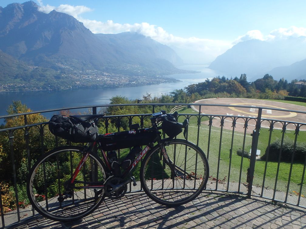
In Civenna I was fooled some instants, as the place looks very similar to Madonna del Ghisallo (for someone who’s never been there), overlooking the Lecco branch of Lago di Como. But as the chapel was devoted to hunters and not cyclists, I realized it was not the good place. Finally I reached the top, with everything I expected: the cyclists’ monument and the chapel (unfortunately, there was someone working inside and he had closed the door to public). At the top I talked briefly with a cyclist that told me it was its 99th climb of the year, and he expected the 100th for the next Sunday. A quadruple godfather of Madonna del Ghisallo, I should have enrolled him for the BIG challenge!


After a short descent, I started the ascent to Colma de Sormano. I had the intention to climb the Muro de Sormano, even if I feared it, as it is renowned to be so steep. But as I said, we were in autumn, and there were more fallen leaves here than anywhere else. On a slope up to 10°, it was not a problem, but with the muro di Sormano gradients, and the amount of wet leaves on the ground, it was impossible. I walked up to the next switchback but discovered a road completely hidden under the leaves. So I turned back to the main road, which is rather steep itself, and reached the pass without problems.


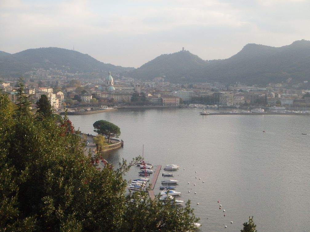
At the end of the descent, I was back at the lake, on the shore between Bellagio and Como. This road is nice, overlooking the lake with little ups and downs, and much less traffic than I had feared. From Como to Cernobbio it was much busier until I reach the Monte Bisbino road. Beautiful views of the lake and the city of Como are offered at the beginning of the climb, and unlike all of the other BIG of the region, Monte Bisbino is reasonably steep, so it was a nice climb. I headed then to Switzerland and Mendrisio, where I stopped for the night, at the foot of Monte Generoso.

Monte Generoso climb begins in a very steep street of Mendrisio, calms down when crossing some houses, then climbs steadily to the finish. There is a train going up the mountain but not functioning as I was there as a new hotel at the top was being built. The road ends at a stop called Stazione Bellavista, but I was not able to confirm that, as a thick fog surrounded me, and I unfortunately saw nothing of the supposed nice views over Lago di Lugano.


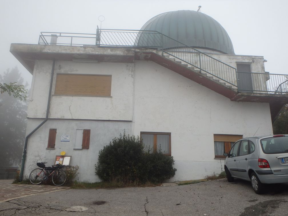
Down in Mendrisio, I turned towards Varese and entered Italy again. I passed along the north of Varese, and some very small roads around Olona, to go to my next BIG, Campo dei Fiori. A huge building, which is in fact an abandoned hotel, can be seen on the top when climbing. But the BIG is set at the observatory nearby, on top of a very very steep ramp. When going down, I thought about go and see the hotel, but was not sure of the way as two roads leave the observatory road in two different hairpins, so I continued my descent directly.

After Campo dei Fiori, I took the direction of San Martino, which is also a dead-end road that leads to a solitary chapel. During the climb, and also at the top, I could enjoy nice views to the Valcuvia below. There were children plays, and also a restaurant up there, but on a week day at the end of October, everything was desert.


Down in Valcuvia, I had not a long ride to be at the foot of passo Cuvignone. In fact from this side, you climb north to passo Sant Antonio, where, instead of going down to lago Maggiore, you turn left to go to passo Cuvignone, which takes you back to Valcuvia again. It’s a steady climb all the way, and the descent towards Cittiglio appeared to me quite steep also.

I took once again a boat in Laveno to cross lago Maggiore, as the last two BIG, Alpe Rossombolmo and Mottarone, were on the Piemontese side. I stopped when I saw a hotel in Mergozzo, along a nice lake, just before Ornavasso, the foot of Alpe Rossombolmo. It was not very late when I arrived, so I was thinking of climbing Alpe Rossombolmo in the evening, after having set up in the hotel. But I feared this climb, and riding at night is nice in a way, but of course hides the scenery, which is the main motivation for this kind of trips. So when the man at the hotel locked my bike in his garage, I let him do without protesting.

The morning after, I headed towards Ornavasso under a generous sun. At the Santuario Della Madonna Del Boden I felt something strange about the road, and realized I should have turned right just before. After a few kilometers on a steep road, the asphalt began to deteriorate, and the road became so steep at a moment that I couldn’t no more stay on my bike. After a flat stretch in the forest, and another impossible to ride steep ramp, I arrived at a wooden arch that showed the beginning of the path to Alpe Cortevecchio. From this point, the road was all rideable, even if there were still very steep ramps, and I arrived finally at the top of the climb.

The road finishes abruptly a few hundred meters before what appears as the last house in this part of the mountain. From here you can see a little below the few houses of Alpe Cortevecchio, and in the distance Isola Madre in the middle of Lago Maggiore. I have read, but after my ride, that walking to the crest just over the road would have allowed me to discover wonderful views of the Ornavasso valley below.

After a cautious descent, I was on the highway towards Gravellona Toce and Omegna. At the south exit of Omegna, I took the Mottarone road. As this road climbs along the lago d’Orta, I expected nice views over the lake but it was hidden most of the time by a wall of trees. After Agrano and a little descent, I climbed to Armeno where I took a one-way street (it’s bad) to save me 20 m of elevation loss before reaching the last part of the Mottarone road.

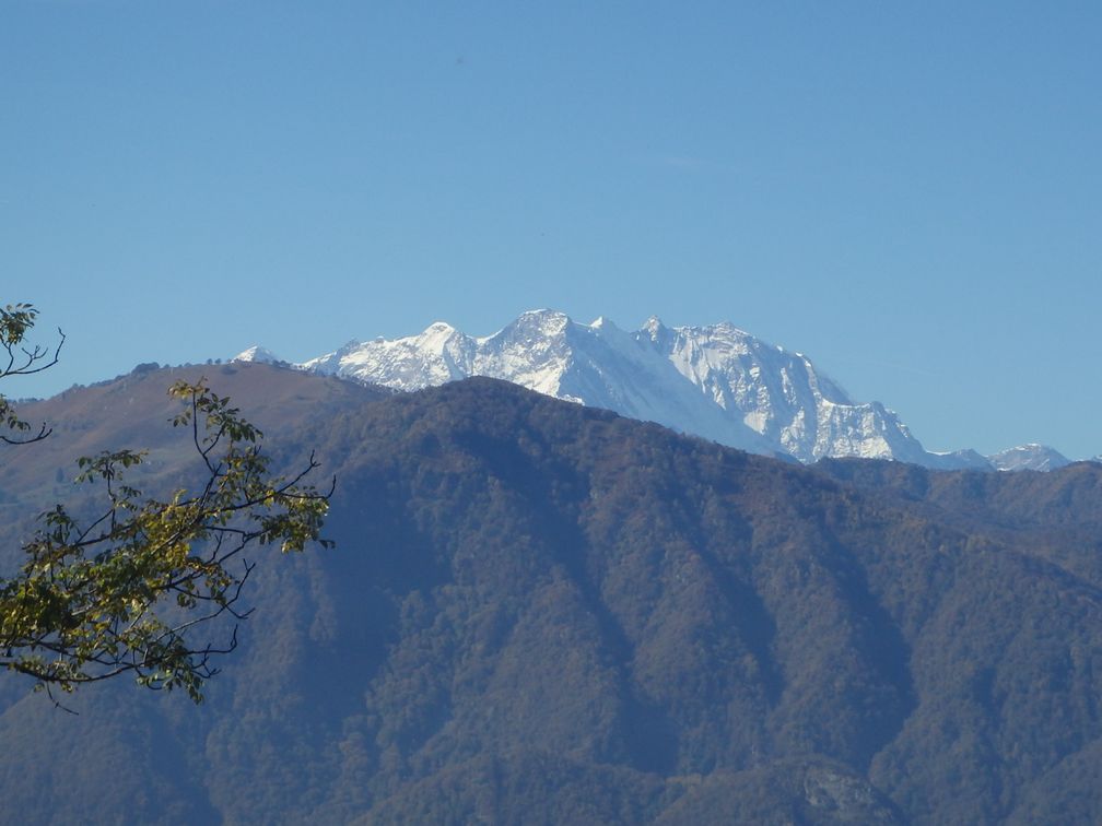
This was the last BIG of this four-day trip, but it turned to be by far the most beautiful, and one of the most (if not the most) extraordinary climbs I’ve ever done. On the first hairpin over Armeno, I began to see a snowy peak (Monte Rosa) rising over the lower, forest-covered, mounts around me. As I climbed, more mountains were showing in every direction. On a stretch looking south, I was even happy to see the familiar figure of Monviso, at a distance of 170 km!

The road from Armeno joins the road from Stresa for the last stretch to a little ski resort. There the road performs a loop around the peak and a cemented, deteriorated and very steep ramp allows to reach the top of the mountain, where stands a big antenna.

From here I enjoyed one of the most beautiful panoramas that can be found, with mountains everywhere: Monte Rosa, Breithorn, high peaks from Saastal, Bernina, and so on. Below could be seen all the lakes: Maggiore, Orta, Varese, Lugano … It was a splendor.

After a long stop and a lot of pictures taken, I started the descent towards Stresa. I passed a tollbooth that seemed strange here as the other road was free and arrived above Stresa, enjoying some last nice views over the town and the Borromee islands.


The trip was now finished and it was time to take the train back home. The Stresa line leads to Milano, where I was unlucky to miss a train to Genova for a few minutes. So I had to wait two hours for the next one that went to Albenga. I finally stopped in Genova, as I renounced to do the ride from Albenga to Nice from midnight to 3 am. When I found myself alone in my hotel room in Genova I thought I should have done it anyway, but never mind, the Sunday afternoon I was back in Nice to see my favorite team defeat 4 to 1 the FC Nantes, and with 12 more BIG in my musette.

Pictures : http://cathie.charbonnier.free.fr/piwigo/index.php?/category/7

mardi 6 septembre 2016

Torino Nice Rally 2016

I fell one day on the internet on an event called Torino Nice Rally (TNR), proposed by an English guy named James Olsen. The purpose was to go from Torino to Nice, over a mix of roads and non-asphalted tracks. It was not a race, nor even a Randonnée, but just an occasion to have a good time on the bike in beautiful scenery. The route was loosely designed by James, with many places where riders could choose between difficult or easier roads. There were some BIG on the way, some nice non-BIG climbs and some wonderful mountain tracks.

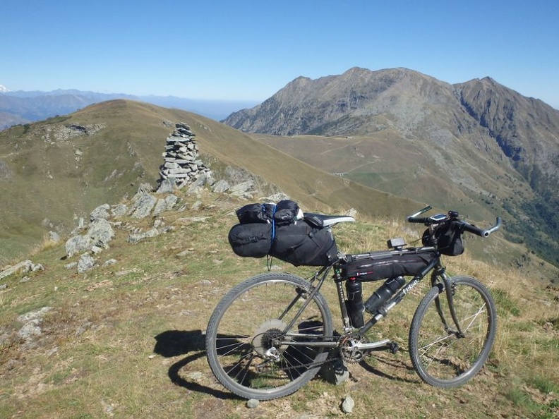
As I live in Nice, and that Torino is easy to reach, I was immediately attracted by this project. The fact that it was a MTB bikepacking ride and that I had no MTB except an old rigid bike with non-functioning derailleur, and that I had no camping gear, was of little impact, as six months were to pass before the start in Torino. Furthermore, having ridden every road in the Alps around Nice, I was willing to enlarge my territory by adding dirt tracks to my possible routes.

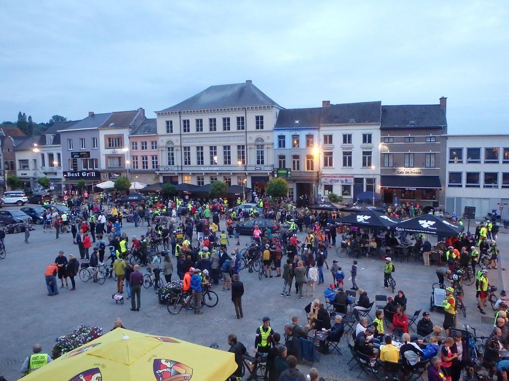
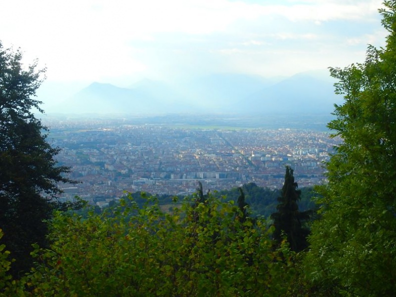
So on Monday, September 5th, I was ready to take the train to Torino, with my MTB, always old but now fully operative, loaded with sleeping bag, bivy bag and everything needed to sleep in the wild (the fact that I hardly used all this expensive stuff is another problem). I have been joined by another rider, Craig, coming from England, that I picked at the airport the day before, and we met two others at the Ventimiglia station. As we arrived at our destination in the beginning of the afternoon, I left the others to find me a hotel, and once installed I went on a ride around Torino, visiting the parks along the Po, and climbing colle della Maddalena where I enjoyed nice views over the town. At the pre-ride diner, in a Torino restaurant, we were about 50 persons or more, hardly knowing each other, with a mix of nationalities brought together by the magic of Internet. And we spent a very nice evening, talking of course only of bike.
The Tuesday morning, we were back at the same place for the official start. To go out of Torino we followed an Italian guy that led us through some beautiful parts of the town, and the palace of Veneria Reale. The program was to go to the airport on the way, to pick some other participants. But it happened that at a roundabout, while I was at the very last position of the peloton, the two riders just before me turned left instead of following the group. I decided in one second to follow them, feeling that they aimed at a shortcut to reach the mountains quicker, what they confirmed as I asked them. 
We rode a bit on the highway, then on a cycling path nearby. On the first climbs, I saw that my young new friends were faster than me, so I told them not to wait. Later, I saw them at a fountain making water. I kept on riding, thinking I would see them again soon in the climb, but never did, I don’t know why.

And so I was the first one of the rally to reach the foot of the colle del Colombardo (don’t worry, I was not the first one at the top). This pass connects val di Viu in the northwest of Torino to val di Susa, a little bit south, with an unpaved road. There’s a solitary church at the pass, and nice views to the Mont Viso. The track continues to climb after the pass, reaches another pass and then a cairn where the descent to Val di Susa begins.

After some 20 km in Val di Susa, I began the ascent to colle delle Finestre. The first part of the climb after the last village has a lot of hairpins in the forest, and then the unpaved part begins, up to the pass, where the asphalt turns back. It was now nearly the evening and I advised an open refuge, Alpe Pintas, where I decided to stop for dinner. I was soon joined by Craig, that I had at home the day before, funny hazard, then three Italian guys arrived, then two more riders, so we were 7 at time to go to bed. When I arrived, the people at the refuge had proposed me to put my tent in some part of their ground, but they finally allowed us very kindly to sleep inside a large room they had in their house.

The morning after, we left at dawn to climb Strada dell’Assietta. It’s an unpaved road, winding its way on the ridge between Val Chisone and Val di Susa, crossing many passes: Colle dell’Assietta, Col Bleiger, Col Lauson, Col Bourget and Col Basset to finish. From the Pian dell’Alpe, in the descent of colle delle Finestre, there’s a long climb to Colle dell’Assietta, then ups and downs to Colle Basset, where begins the descent to Sestriere.

The normal route of the TNR from Sestrière was through col de Montgenèvre directly to Briançon. But as I’ve already climbed this pass, I went instead to the col de l’Echelle that I had not ridden yet. So, in Cesena, instead of taking Briançon road, I went down to Oulx, then turned towards Bardonecchia where I headed in the “Colle della Scala” direction. It was a nice climb, with large hairpins, and views over Bardonecchia to the Rochemolles valley, where I’ve been some years ago to climb the Sommeiller.

I then went down to Briançon towards Izoard. The program of the TNR proposed, leaving the Izoard road in Cervières, a detour by Col de Peas, which lies a little east of the Izoard. But I left that to the real MTBers, being myself only a road rider that turned MTB for the occasion. After the Izoard and a good stop at the nice bakery of Arvieux, I continued on well-known roads to the Agnel pass.

From this point, if I can annoy my readers with personal considerations, something went wrong in my head. I had evaluated at home my journey at about 600 km and 17000 m of elevation gain. According to my usual standards with my road bike, it was a trip that could be easily done in 4 days, so I aimed a finish on Friday. And despite I was perfectly aware that riding on stony tracks with a fully-loaded old MTB was of course slower than on tarmac with an efficient carbon road bike, and that I had no particular reason to come back home earlier than the Sunday, I was not able, for some weird twist inside my mind, to set a new, more realistic and more relaxed, planning. And so I kept pedalling late in the evening, stopping too late to have dinner, leaving too early and not sleeping enough, until the final exhaustion that made me renounce to the last part of the route.

This being said, let’s continue with the trip. It was getting late as I was climbing Agnel pass. I could (should) have stopped at the refuge at the top, but I had fixed Sampeyre as my stop for this evening. So I kept on climbing and was at the pass at about 21 pm, as the last days of light were fading away. I then went on a long descent, reached Sampeyre like I wanted to, and stopped at a hotel there at about 22 pm.

Nevertheless, the morning after, I was in the colle Sampeyre climb before dawn. Of course, when I reached the pass, the sun was up. At colle Sampeyre, like in Cervières, two routes were proposed: the road going down through Elva directly to Ponte Marmora, or an unasphalted track, named Strada dei Canonni, that followed the ridge between Val Varaita and Val Maira, mainly on the Val Maira side. This road has been presented by James as a rough one, so at first I decided to avoid it, especially as, despite having climbed colle Sampeyre a few times now, I never passed by vallone d’Elva, which looks quite spectacular. But when I saw some views of the Strada dei Cannoni on the internet, it looked so nice that I had to take it. And in fact the scenery was wonderful, winding along nude slopes, overlooking Val Maira of more than 1000 m. But as promised, it was a tough part to ride, the track being very stony.

After having left the high altitude, I entered in the forest, with much less to look around, and on a track that wasn’t getting easier at all. The route has been drawn by James down to Dronero, on the very beginning of the Val Maira. Going all the way back from this point to Ponte Marmora on the valley road had appeared to me as a serious drawback. So when, arrived at some point called Colle Birrone, I saw a sign on my right indicating San Damiano Macra, I went this way without hesitation. Well, I have not ridden the part between colle Birrone and Valmala, and I don’t know what I’ve missed, but when I was on the road it appeared to me as a very good compromise.

So, after a not so long than I had feared ride along the valley, I arrived in Ponte Marmora. The program here was to ride the altopiano della Gardetta, a high plateau lying between Val Maira and Valle Stura. An unpaved road crosses it at an altitude between 2100 and 2500 m. Here again, there were two solutions for reaching the plateau: via Acceglio, Chialvetta and a hard to cycle MTB path, or via the asphalted colle del Preit, both sides joining just below passo della Gardetta.

Apart that I feared the MTB side, I had something to conclude with colle del Preit. Two years ago, I cycled all the way from Nice to climb this pass, as it was the nearest over 2000 m I have not been yet. But after having ridden all day and arriving at the top by the late afternoon, my camera ran out of battery just for the last picture, of the sign pass. I promised then to turn back, as climbing a pass without taking the picture at the top is doing half part of the job. So in Marmora road I turned right towards Canosio (turning left would have taken me to the Esischie and colle dei Morti/Fauniera passes). The climb was as steep as last time, but I finally reached the pass. I took my picture and continued climbing, on a dirt track but well rideable, up to the crossing of the passo della Gardetta road (I have a little regret not to have gone to this pass, but this will be a motivation for coming back next year). I found that the road through the plateau was much longer, and rougher to cycle in some parts, than I had expected. And I was happy that a flat in the descent of the Esischie delayed me and made me renounce to ride it with my road bike the last time I’ve been there.

Apart from the cycling considerations, I have no words to describe the scenery. It’s beautiful in every direction.  From colle del Preit, the road performs a big loop all around the place, first going westwards to passo Gardetta, then following the south side eastwards, with many passes on the way. At some point, the crests over the Tinée can be seen in the distance, then the track comes across some military ruins and a funny open air sanctuary at the colle della Bandia, overlooked a good part of the way by the impressive Rocca la Meija.

But all good things must come to an end, and the exit of the plateau arrives, at colle Valcavera. There begins the descent to Demonte, 2 km below colle dei Morti. In Demonte I just had to cross Valle Stura to climb Madonna del Colletto. It’s a road quite steep all the way, but not very long. From the pass, I went down on the other side to Valdieri, in Val Gesso. To leave Val Gesso, the TNR proposed another pass, colla delle Goderie, that allows to reach Vernante through a little valley called Roaschia.
I arrived in Roaschia as night was falling and should have stopped there. But I had fixed Limone as my stop for this day, and the end of the valley seemed to show a pass that was not far away, so I continued. But what looked ahead like the top of the road was in fact just the beginning. The pass turned to be much higher than I had expected and furthermore the road turned to gravel. There I began, for the first time of the trip, not to appreciate my ride. I was climbing in the night, tired, not seeing the end of the pass (but, as I said, it was all my fault).

I finally reached the pass, which was followed by little ups and downs before the beginning of the real descent towards Vernante. I arrived there of course very late, and stopped at the first hotel I saw (that was about to close). Here again it was too late for meal, and here again I was back on the road in the very first hours of the morning, long before sunrise. I began the gentle climb leading to Limone, annoyed by the traffic that was important despite the early hour.

But, after a few kilometres on this road, exhaustion fell suddenly on me. I had nothing to eat but one or two bars, that didn’t change much my physical state. I continued to climb, at a very slow pace. I passed along Limone as it was still very dark so thought it was not worth the detour to look for something open. In the Limone 1400 village I saw nothing open, so I continued climbing. A little before colle di Tenda there was a bar announcing an opening at 8:30. I could have waited for its eventual opening but thought finally it was useless.
I felt in fact so exhausted that I was quite certain that even after a (hypothetical) good meal, I wouldn’t be in a good condition to ride all the way the Via del Sale, which I knew was hard, having ridden the beginning a few years ago. So in the col de Tende I called it quits. The fact that the Roya valley is reachable from Nice also led me to think that I could do this ride anytime and that it was stupid to do it now when I was too tired to appreciate it.

So I went down towards Tende through the many hairpins of the descent. When arrived in Tende, I had finally the good breakfast I was striving for since hours. Having looked at the train timetable I saw I had time to go down and catch it in Breil, but when arriving in Saint-Dalmas, I finally chose to stop and wait quietly there. Finishing the ride with the train may sound strange, but for me that live in Nice, it’s a thing I do frequently when I go riding in the Roya. And I was not in the mood for riding a 10th time in the year col de Brouis and col de Braus roads.

In the train back to Nice, I had time to think about my journey. I couldn’t understand, and don’t understand even now, why I decided to finish at all cost my trip on the Friday. At the day of today, I have not yet ridden the via del Sale like I promised myself on top of col de Tende. So now I hesitate between riding it next spring or keeping it for the 2nd edition of the Torino Nice Rally. 
Despite this little frustrating end, I have only good souvenirs from this TNR, from my little ride in Torino the day before the start to, let’s say, the beginning of my climb to colla delle Goderie. I will certainly do my best to join the 2nd edition, and I’ve already started to think about my future route, linking the parts I’d like to do again and the ones I’d like to discover.